
 | ||||

150 Years of Gold Exploration
in the Monashee...
While we may never know the exact date and time when gold was first discovered glittering in the sandbar, we know that in 1862 the first whispers of gold being discovered at Cherry Creek had reached the colonial government, and that the discovery was important enough, that by 1863 Governor James Douglas had commissioned bridge and road contracts to better manage the influx of activity which included 200 miners who had begun working placer claims.
Welcome to the Monashee Almanac
The Monashee Almanac is an online journal that shares history, mysteries and stories about early British Columbia and in particular the Monashee, Okanagan and Shuswap. We encourage exploration into the lesser-known parts of the past by presenting engaging stories told by great storytellers.
The World in 1862
In 1862, it must have seemed like the world was coming apart at the seams. In the Monashee and the Okanagan the original people of this land were seeing that their world was under siege from white traders and prospectors. Ranchers were encroaching into wilderness areas bringing with them herds of cattle that must have seemed like a plague of locusts scouring the land.
The whole world saw British Columbia as a place where gold was everywhere. There were large numbers of men coming from the south, well armed and many of them taking the law into their own hands.
The entire world was changing, and it was becoming violent largely because of American’s embracing a policy of Manifest Destiny which would seek to expand the boundaries and influence of the United States – and much of that expansion was happening in North America’s pacific northwest.
This first historical series in the Monashee Almanac contains stories about the world and what life was like in 1862, so that we may better understand what brought people to the Monashee 150 years ago.
In this Monashee Almanac Production
In 1862 why would Governor James Douglas send W.G. Cox, Magistrate and Gold Commissioner at Rock Creek, to explore an unpopulated area with a view to establishing a "horse road"?
The Mysterious Discovery of Gold in Cherry Creek
Why would Governor Douglas commission a road to be built?
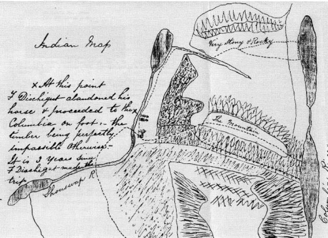
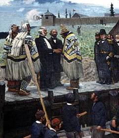
In the summer of 1862 Governor James Douglas sent W.G. Cox, Magistrate and Gold Commissioner at Rock Creek, to explore the territory between the head of Okanagan Lake and the Columbia River with a view to establishing a "horse road" (a pack-horse trail). An “x” on the old Indian Map was the end of the road, 150 years later we know the road as Highway 6, and the "x" as Cherryville.
The Old Indian Map - X Marks the Spot
The Road Plan to the Monashee was registered August, 8th 1862
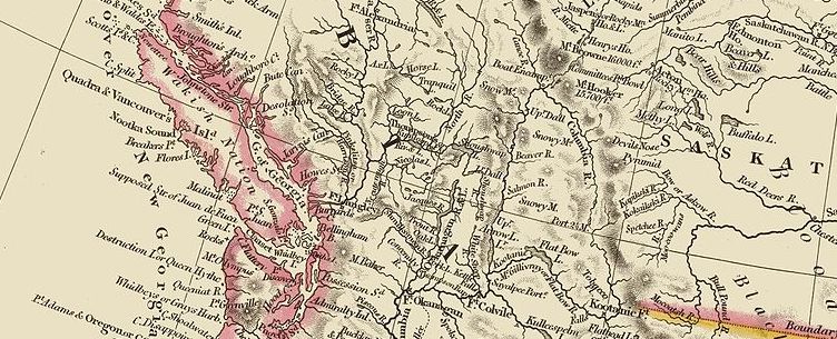
A map of the Colony of British Columbia. Printed in 1846, it would have likely been the map that people used to understand the geography of the colony in 1862.
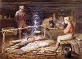
Mrs. Angus Woods wrote of the Cherry Creek mines in the 1929 edition of the Okanagan Hisorical Society Report. She writes an optimistic account on the mining activity as recorded by the newspaper the “British Columbian” on November 21, 1863.
Beginnings at Cherry Creek
An Okanagan Historical Society account from 1929 about 1863

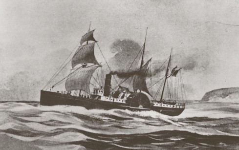
Cherry Creek, Rock Creek and Salmon River in Eastern Washington Territory were all contributing to word of inland gold strikes just west of the Rockies. People were on the move, the American Civil War was underway and an escape to the more remote places of the New World invited many to seek their fortune. Victoria was a primary destination, and its gateway was linked primarily to San Francisco. But in the late afternoon of March 12, 1862, the Brother Jonathan steamed into Victoria - and hell broke loose on Earth.
1862: An Epidemic of Gold and Disease
One of the greatest atrocities in B.C.’s history as Smallpox spreads
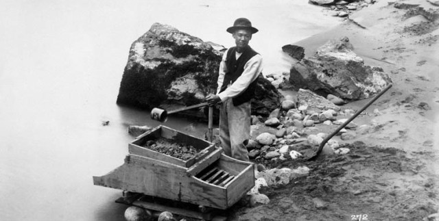
Cashing in Pay Dirt
Lots of gold but a shortage of currency
By 1862 the new colony of British Columbia was in chaos, miners continued to flood into the remote parts of the colony including Cherry Creek. If you were a miner and you had extracted gold out of the creek, just where would you cash it in? There was an extreme shortage of coined money and the miners had great difficulty exchanging their gold for coins.
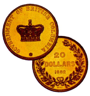
Early Money in the Colony
Different currencies and many different values
In 1862, British Columbia and Vancouver Island were not yet part of Canada. As part of the British Empire, British Columbia traded in “sterling” the word used to describe British currency.
The Gold Diggings of British Columbia
From Illustrated London News, March 29,1862.
...Apropos to the subject of river mining, I would notice the remarkable fact that the streams which flow from the east are observed to be all auriferous, while those which run from the west are not so. Does this distinction prove that the source of a all the gold spread over the goldfield is in the Rocky Mountains?
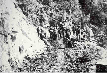
The first known photograph of building the Cariboo Trail.
In July 1986, a previously unknown linen tracing of a map was found in the Surveyors General’s office in Victoria. The linen map had been lost for nearly a century. The map reveals a detailed account of the journey W.G. Cox made to Cherry Creek in 1862. It also tells us in detail who discovered gold and how the gold rush began.
The Official Account of Gold
being Discovered in Cherry Creek
“…he took four handfuls of sand from the creek
and washed it in his frying pan.”
Economic Development on a Changing Planet
Extracts From the British Columbia Immigration Report of 1862
When gold was discovered at Cherry Creek in 1862, the new colony of British Columbia was keeping careful immigration records and within them is a vast collection of information about how the colony was developing. This story represents a report from Governor James Douglas. 1862 began with certain disadvantages, owing to the unprecedented duration and severity of the winter.
Extracts from the Canadian Immigration Report
Insights about the people who entered Canada in 1862
These highlights provide an insight about the people who arrived and the fierce conditions they faced on their way to the new world.
&
Legends
Landscapes
Natural Mysteries
A long, long, time ago, when the world was young and fresh, before hatred, greed and strife entered, and all was peace and happiness, and all the animals lived harmoniously together, the Bear, Elk, fox, Coyote and all animals were ancestors of human beings.
Old Coyote Makes a Great Kettle at the Falls
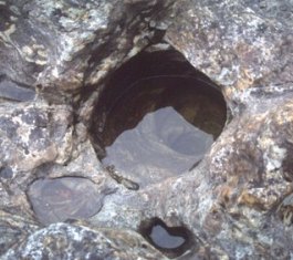
A rare phenomenon exists at Shuswap Falls so mysterious that geologists remain puzzled to this day. Pot-holes are rather rare geographical features found in hard-rock riverbeds.
The Kettle Shapes
of Shuswap Falls
The rare phenomenon
of river potholes
The Monashee Almanac is an online journal that shares nature, history, mysteries, stories and the future within Inland British Columbia and in particular the Monashee, Okanagan and Shuswap.
Celebrating Nature, History, Mysteries, Stories and the Future
The Monashee Almanac is an educational platform that stands the test of time.
Through our e-book series we present history to adults and children trough engaging graphic design. Through our print publications we offer history buffs a chance to add a collectible to their home library.
A Mystery Unfolds
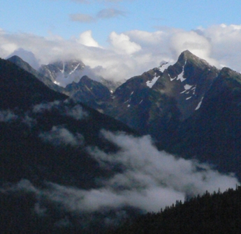
Ancient World of the Monashee and Okanagan
The southcentral interior of British Columbia is rich in natural history, in particular the Okanagan Valley as it links north to the interior plateau and east to the Monashee Mountain range. In this region the most recent geological events begin to unfold beginning with a torrent of molten lava caused by eons of volcanic activity.
Genesis
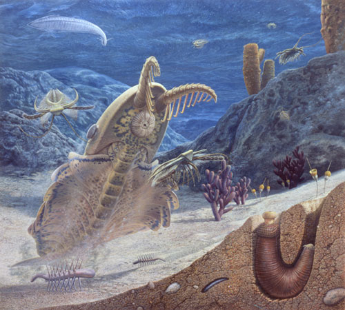
Much of what is now southern British Columbia was beneath an ocean 505 million years ago. Fossils of these marine creatures have been found in the Burgess Shale Formation, located near the town of Field in Yoho National Park.
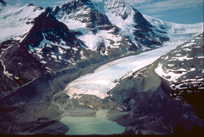
An Ancient Glacial Lake in the Okanagan
What proof do we have of an extraordinary megaflood in the Okanagan?
A cataclysmic chain of events originating under this southern B.C. ice, perhaps triggered by volcanic eruptions from below and surface meltwater making its way through the immense ice sheet, would change prevailing theories about one of the greatest flash floods of the last Ice Age.
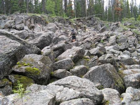
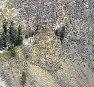
Denison-Bonneau Provincial Park offers some easy access to mysterious geological features and an abundance of post-volcanic and glacial history. Rock hoodoos hidden in the forest define an age when the Earth was a torrent with lava and volcanic vents. Because the area is remote and largely unknown, much of the secrets of this geological landscape have yet to be revealed.
Mysterious Geological Features
and Getting Fossilized
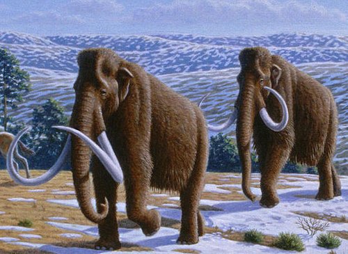
Properly celebrated as Canada's mapmaker, David Thompson charted the entire western interior from Hudson Bay to the Pacific Ocean in 22 years of travels starting in 1789. He is, of course, closely associated with the Columbia Basin, the Kootenay region and the edge of the Monashee. In one expedition he may have found mammoth tracks.
David Thompson: Mammoth Hunter
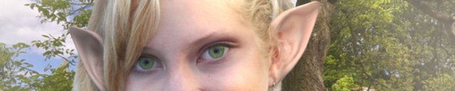
Could there be Sidhe in these mountains?
At the time of the naming, correspondence to and from BC's Chief Geographer describes “Monashee” as being Gaelic, and derived from the phrase monadh-sith, "mountain of peace." The Monashee Almanac takes a meta-historical journey into a hidden translation of “Monashee” and speculates about if there are elves and faeries in these mountains?
Mona-shee
The Bushrat Inventory, written by Richard Mackie unfolds during a BC Studies fieldtrip to the Mackie family cabin on Sugar Lake. Mackie describes the story as taking place ten years after one of his more unconventional archaeological and archival ventures.
...one winter at Sugar Lake, for example, they took every piece of cutlery down to their den and thoughtfully traded it for kindling, twigs, and pine cones - a process which, if unchecked, would eventually have turned the cabin back into forest. The bushrats specialize in the art of transforming the alien into the familiar.”
The Bushrat Inventory
Monashee Pioneer Stories:
Radio Interview with Lumby Pioneer J.W. Inglis
From the Imbert Orchard Collection in the BC Archives
Now thanks to the Imbert Orchard Collection in the BC Archives, North by Northwest and CBC Radio have made available to the Monashee Almanac a very special Voices of BC interview with Lumby pioneer J.W. Inglis.
At the Wildcraft Forest we publish books. Our fiction and non-fiction book titles are both engaging and thought provoking.
Wildcraft Forest provides encouragement and will help a new generation of writers focus on subjects such as environmental sustainability, current events, permaculture, spirit, health, visionary change, children’s literature, nature and wildcrafting.